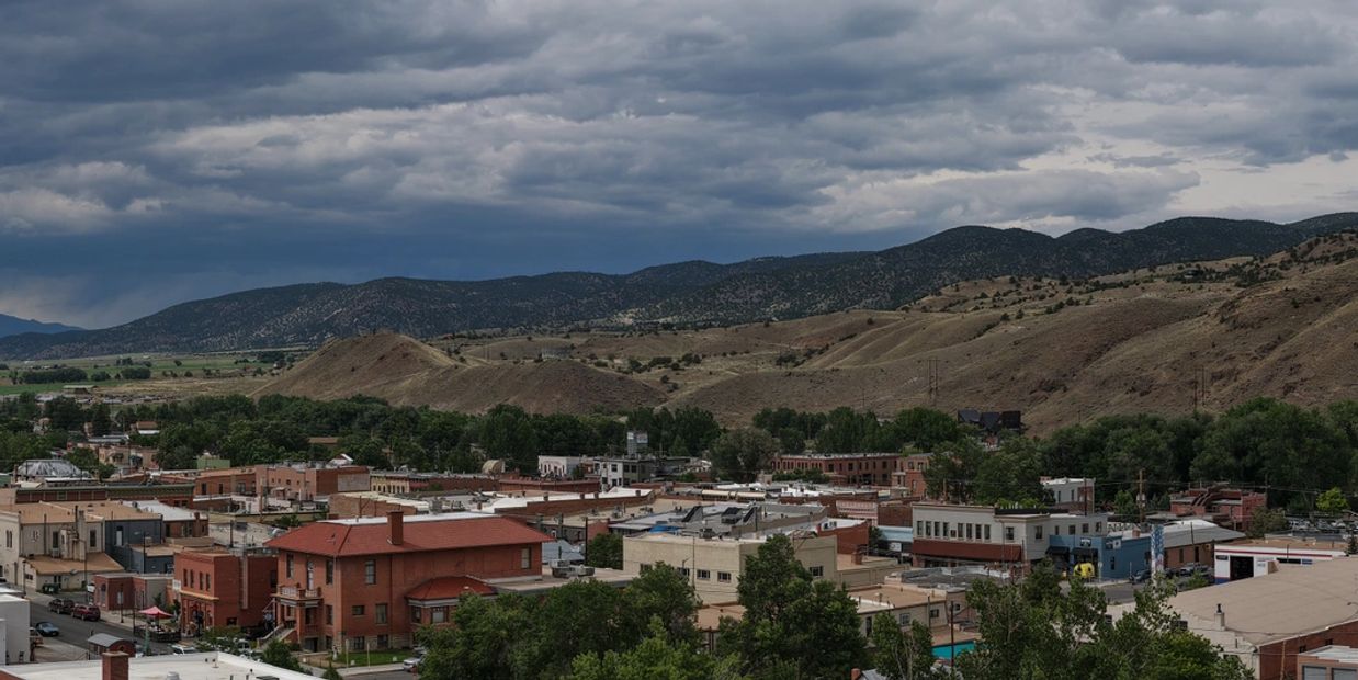
About Sky Trail Drone

Sky Trail Drone Service
Elevate your vision and capture results with Sky Trail Drone Services.
Precision - from the ground up — and the sky down.
Where residential and commercial real estate meets innovation from the sky!
Whether you are a real estate agent looking to elevate your listings,
a construction manager needing to monitor, manage or market projects, or
an outdoor brand seeking cinematic visuals—Sky Trail Drone delivers aerial views with impact.

Residential
I help real estate professionals elevate their listings—literally.
As a certified drone pilot with a background in construction project management, I specialize in creating high-impact aerial visuals that make homes and properties shine. From sweeping exterior shots to dynamic neighborhood flyovers, my drone services help agents showcase listings in ways that grab attention and drive engagement.
With years of experience managing complex builds, I understand how to highlight the features that matter most to buyers—whether it’s curb appeal, lot layout, or proximity to amenities. I also offer aerial inspections and progress documentation for new developments and renovations.
If you're looking to boost your marketing, impress clients, and sell homes faster, let’s connect. I bring the sky to your strategy.

Commercial
With decades of experience leading complex construction projects, I’ve built a reputation for delivering results—on time, on budget, and with precision. My career has been defined by integrating advanced technologies into traditional workflows, helping teams work smarter and safer.
Today, I bring that same innovation to the skies. As a certified drone pilot, I specialize in aerial solutions that transform how we manage, monitor, and market properties. From real-time site inspections to stunning visual assets for commercial and residential real estate, I help clients see their projects from a whole new perspective.
Let’s connect if you're looking to elevate your operations or showcase your property with cutting-edge aerial imagery.

Our Mission
At Sky Trail Drone, our mission is to capture breathtaking aerial imagery that elevates your project.
About Sky Trail Drone Services

Benefits For Commercial
Why Drones Matter in Residental Real Estate
Why Jim Camp and Sky Trail Drone?
Construction firms are increasingly seeing drones not just as a tool—but as a strategic asset.
Why Drones?
Smarter. Safer. Faster. More Accurate.
Drones are transforming construction by delivering real-time insights, reducing risk, and improving communication across teams.
Services Offered
Site Surveys & Mapping
Fast, accurate topographi
Construction firms are increasingly seeing drones not just as a tool—but as a strategic asset.
Why Drones?
Smarter. Safer. Faster. More Accurate.
Drones are transforming construction by delivering real-time insights, reducing risk, and improving communication across teams.
Services Offered
Site Surveys & Mapping
Fast, accurate topographic data for planning and layout
Progress Monitoring
Weekly aerial updates to track milestones and verify work.
Infrastructure & Site Inspections
· Visual inspections of rooftops, towers, bridges, solar arrays, and other hard-to-reach structures
· Regular site documentation for compliance, safety audits, and maintenance planning
Safety Inspections
Access hazardous areas without putting workers at risk
Marketing Visuals
High-resolution images and videos for investors, clients, and future bids
Pre-Construction Documentation
Capture existing conditions before breaking ground
Post-Construction Showcase
Highlight finished projects for portfolios and promotions

Why Jim Camp and Sky Trail Drone?
Why Drones Matter in Residental Real Estate
Why Jim Camp and Sky Trail Drone?
- ✅ Decades in Construction Management I speak your language—understand timelines, budgets, and boots-on-the-ground realities.
- ✅ FAA-Certified & Insured Fully compliant with regulations and safety standards.
- ✅ Tech-Forward Approach I integrate aerial data into your workflow, not just drop off files. At Sky Trail Drone, I take a person
- ✅ Decades in Construction Management I speak your language—understand timelines, budgets, and boots-on-the-ground realities.
- ✅ FAA-Certified & Insured Fully compliant with regulations and safety standards.
- ✅ Tech-Forward Approach I integrate aerial data into your workflow, not just drop off files. At Sky Trail Drone, I take a personalized approach to every project I work on. I take the time to understand your vision and goals, and then use my expertise to bring them to life. Sky Trail Drone's attention to detail and commitment to quality ensure that you'll be thrilled with the final product.
Sky Trail Drone's specialized aerial solutions are designed to meet the diverse needs of clients across industries. With FAA-certified expertise and aerial drone technology, each service is executed with precision, efficiency, and a commitment to high-quality deliverables.

Why Drones Matter in Residental Real Estate
Why Drones Matter in Residental Real Estate
Why Drones Matter in Residental Real Estate
Visuals sell. Drones elevate. In today’s competitive market, buyers expect more than static photos—they want immersive experiences. Drone imagery delivers stunning aerial views that captivate, inform, and convert.
Aerial Photography & Video Showcase homes, lots, and neighborhoods with cinematic quality
360° Virtual Tours
Let buyers exp
Visuals sell. Drones elevate. In today’s competitive market, buyers expect more than static photos—they want immersive experiences. Drone imagery delivers stunning aerial views that captivate, inform, and convert.
Aerial Photography & Video Showcase homes, lots, and neighborhoods with cinematic quality
360° Virtual Tours
Let buyers explore properties remotely—perfect for relocations and luxury listings
Neighborhood Flyovers
Highlight proximity to parks, schools, and amenities
Pre-Listing Marketing Packages
Create buzz before a property hits the market
Development Site Overviews
Help investors and buyers visualize future builds or phases
Progress Documentation
Track construction for new builds and renovations
· High resolution stills and 4K video for real estate, outdoor branding, tourism, and adventure content
· Dynamic tracking shots and cinematic flyovers using stabilized gimbal systems
· FPV drone footage available for high-energy, immersive storytelling
Whether you're a construction manager needing topographic data, a real estate agent looking to elevate your listings, or an outdoor brand seeking cinematic visuals—Sky Trail Drone delivers aerial intelligence with impact.
This website uses cookies.
We use cookies to analyze website traffic and optimize your website experience. By accepting our use of cookies, your data will be aggregated with all other user data.